Chinese scientists provide Turkish earthquake relief analysis to UN

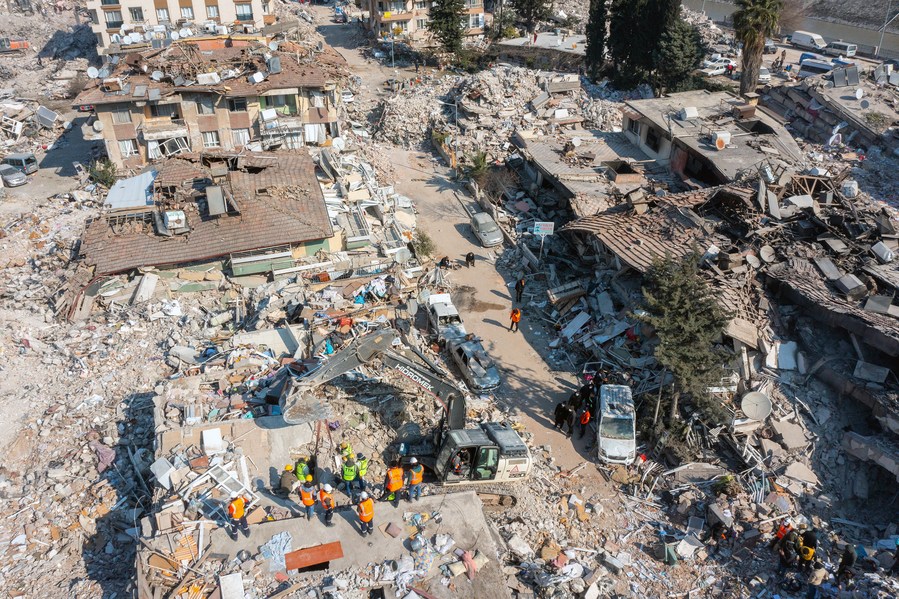
This aerial photo taken on Feb. 12, 2023 shows a scene after the earthquake in Antakya, Hatay Province, Türkiye. (Photo by Mustafa Kaya/Xinhua)
BEIJING, Feb. 13 (Xinhua) -- A research team from Wuhan University has provided remote sensing data from the earthquake-hit areas of Türkiye to the United Nations Satellite Centre (UNOSAT) to aid relief efforts.
Following the first earthquake, UNOSAT announced the activation of its emergency mapping service in the affected areas.
A research team from the State Key Laboratory of Information Engineering in Surveying, Mapping and Remote Sensing at Wuhan University was invited to participate in the program to map the lights in the areas at night through remote sensing data.
"In the past, it was generally believed that the closer the area was to the epicenter, the greater the loss. In fact, this did not take into account the different disaster resistance capabilities in different areas," said team leader Li Xi.
The changes in the lights can directly reflect the scale of damage in different cities and can be used to assess disaster resistance capabilities. In the case of resource shortages, it can play an important role in the formulation of more targeted rescue strategies, Li said.
The team has analyzed satellite data, which is updated every day, combining macro and micro observations. They used China's high-resolution satellites to carry out the high-precision monitoring of lights in affected areas at night.
The earth science satellite SDGSAT-1, developed by the Chinese Academy of Sciences, provided pre-disaster data for researchers to compare with the post-disaster conditions.
The commercial space telescope Yangwang-1, developed by Origin Space Technology Co., Ltd., and the micro-nano satellite QMX-1, developed by Wuhan University, have also been employed.
While accurately observing lights through high-resolution satellites at night, the team also used data from Suomi-NPP, a U.S. meteorological satellite, to obtain data from a longer timeframe and in a broader range, and to analyze the light trends.
The team has reported the results of its analysis to UNOSAT, the World Food Program and other agencies. The results could be used to help formulate relief policies and monitor the progress of post-disaster reconstruction.
"The data may help policymakers analyze the disaster situations in different areas and allocate relief resources better," Li said.
"We've been involved since the day after the earthquakes, and we will be tracking and observing the area for the coming months or even years," Li said.
Currently, Li's team and UNOSAT are collaborating under the pilot initiative "Night-Time Light Remote Sensing for Sustainable Development Goals" from the Group on Earth Observations. The initiative aims to quantify the progress of several indexes related to the 2030 Sustainable Development Goals using night-time light data.


